ENVIRONMENTAL workers are hoping to finally deal with Barnsley’s archaic ‘Victorian’ plumbing that is expected to cause continued flooding as climate change brings new pressures and more extreme weather.
Many will have noticed a rise in the amount of named storms, as Storm Darragh brought strong gusts of more than 40mph to Barnsley two weeks ago and sudden snow and severe rain battered the borough in November.
These problems are adding further issues to the already struggling infrastructure across South Yorkshire, which was built centuries ago when areas had lower populations and more consistent weather.
As such, Connected Water a partnership between the county’s four borough councils, Yorkshire Water, the Environment Agency and the South Yorkshire Mayoral Combined Authority (SYMCA) is preparing to overhaul the systems, providing increased flood protections to people in at-risk areas.
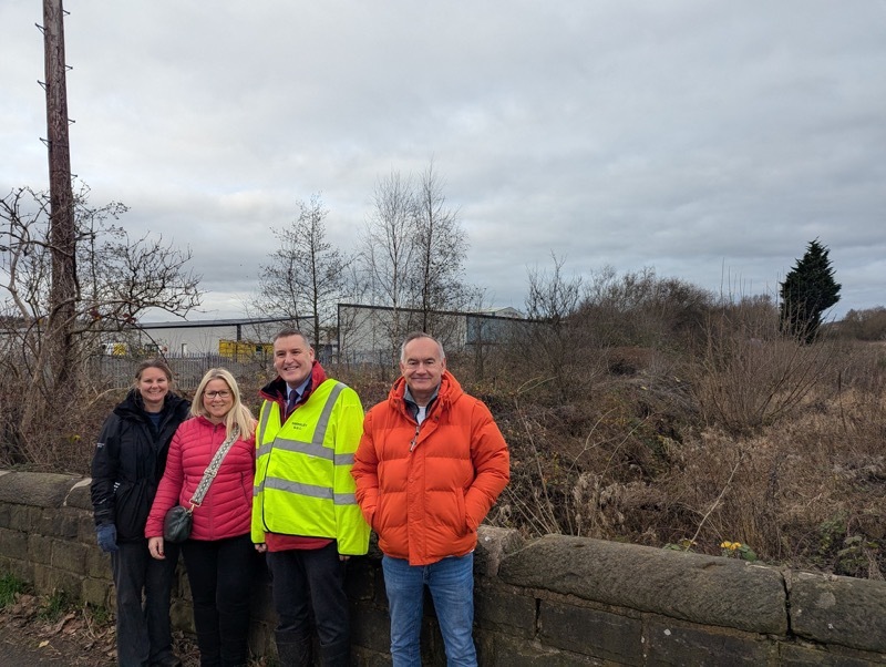
Representatives met near Bulling Dike in Wombwell, which is one such area, to discuss plans.
Eddie Allen, the council’s flood risk coordinator, told the Chronicle: “With climate change’s impact you can’t prepare for everything that’s happening around the world.
“The problem in this country is that rivers, drainage boards, dikes, watercourses, they’re all Victorian they’re not designed to cater for what is happening here today.
“When you go back to that time all of this was allotments, there were no major developments.
“So over the years all these developments take place and water goes into the dikes which are really only designed to drain farmland, not highways nobody thought about the effect today.”
Plans are now in place to develop a Lowe Valley Flood Prevention scheme, which will improve the infrastructure, protecting the nearby homes and providing fresh green space for residents.
The Chronicle understands that further proposals are being set for around six other areas that are facing similar issues.
“The plan here is to take the River Dove offline, so it doesn’t flow directly into the River Dearne,” Eddie added.
“So we’re hoping to build large attenuation ponds, which basically will improve wildlife, habitat and natural biodiversity.
“These sites will have access to allow people to walk around them, feed the ducks and the birds, and provide a nice area to go and visit.
“It means we’re doing several things all at once, but the main thing is protecting properties, protecting the people around here and reducing the impact we can never stop flooding, but we can reduce the impact.
“Flooding does upset people, it causes health problems people, especially elderly people, don’t want water through the front door, it’s terrible.
“What we’re doing isn’t just for the council or environment, it’s about looking after ourselves and protecting people.
“You follow this downstream and it leads to the Don, which floods and discharges into the River Ouse that ends up discharging itself into the North Sea so this water here finds itself all the way to Bridlington sea front.
“So it’s a long journey and we’re trying not just to reduce the impact in Wombwell, or Barnsley, but also downstream.”
Coun Kevin Osborne said: “The recent visit by the Environment Agency was both productive and useful. The Connected by Water partnership approach to flood risk management is working well within Barnsley. I look forward to future engagement on practical solutions to flood risk in our borough.”


